Geotechnical investigation in Hobart is the systematic process of characterising the ground beneath a site to inform safe and economical design, construction and risk management. It encompasses everything from desktop studies and walkover surveys to intrusive fieldwork, in-situ testing, laboratory analysis and interpretive reporting. In a city shaped by steep dolerite hills, deep alluvial valleys and reactive estuarine clays, understanding what lies below the surface is not optional; it is the foundation of every successful project. Whether you are planning a residential extension on a sloping block in South Hobart, a multi-storey development along the Macquarie Street ridge or infrastructure works on the Eastern Shore, proper investigation reduces uncertainty, controls cost and protects life.
Hobart’s geological setting is dominated by Jurassic dolerite of the Tasmanian Dolerite Province, which forms the iconic backdrop of kunanyi / Mount Wellington and much of the city’s elevated terrain. This strong but highly jointed rock can present challenges such as block falls, variable weathering depths and difficult excavation conditions. The lower-lying areas, including the Hobart CBD, Sandy Bay and Glenorchy, are underlain by Quaternary alluvium, colluvium and the notoriously sensitive estuarine sediments of the Derwent River floodplain. These soft, compressible soils demand careful assessment of bearing capacity, settlement and liquefaction potential, especially where they contain organic layers or acid sulfate soils. Groundwater is another critical factor, with perched water tables common on hillsides and tidal influences affecting near-river sites.
Australian practice is governed by a robust framework of standards, most notably AS 1726:2017 Geotechnical site investigations, which sets out minimum requirements for planning, execution and reporting. Depending on the project, complementary standards such as AS 2870 for residential slabs and footings, AS 2159 for piling and AS 4678 for earth-retaining structures may also apply. In Tasmania, additional considerations arise from state-specific codes, council planning schemes and the Building Act 2016, which mandates that building work must be carried out in accordance with the National Construction Code. For sites near waterways or on steep land, natural hazards overlays and the Tasmanian Planning Scheme may trigger mandatory geotechnical assessment before a permit is issued.
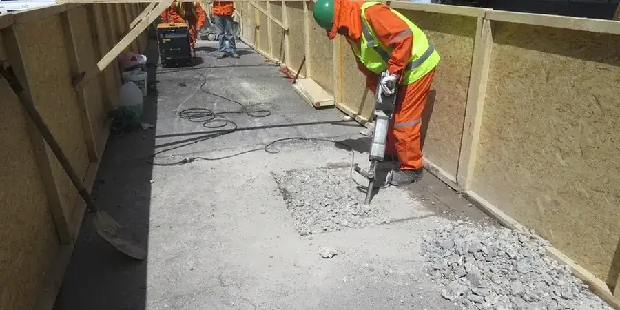
Investigation is required across a broad spectrum of projects. Residential builders rely on it for foundation design on reactive or filled sites, while commercial developers need it for basement excavations, retaining walls and high-rise footings. Infrastructure projects such as bridges, tunnels, road cuttings and stormwater systems demand a deep understanding of ground behaviour under both static and dynamic loads. Even smaller works like retaining-wall replacements or driveway construction on Hobart’s characteristic slopes often begin with a targeted investigation. Common field techniques include the Standard Penetration Test (SPT), which provides disturbed samples and a measure of relative density or consistency, and the excavation of an exploratory test pit to visually log shallow strata, assess fill and obtain bulk samples. These methods are frequently supplemented by cone penetration testing, borehole drilling and laboratory classification to build a defensible ground model.
Common questions
What is the purpose of a geotechnical investigation in Hobart?
A geotechnical investigation identifies the soil, rock and groundwater conditions at a site so that engineers can design foundations, earthworks and retaining structures safely and economically. In Hobart, where dolerite bedrock, soft estuarine clays and steep slopes are common, the investigation reduces the risk of unexpected ground behaviour, construction delays and structural failure by providing data on bearing capacity, settlement, slope stability and excavation difficulty.
When is a geotechnical investigation legally required for a project in Tasmania?
A geotechnical investigation is required whenever the National Construction Code, the Tasmanian Planning Scheme or a council permit condition mandates it. This typically applies to commercial, industrial and multi-residential buildings, as well as any structure on steep or unstable land, near waterways or on filled ground. Residential projects on reactive clay sites also need investigation under AS 2870 to comply with the Building Act 2016.
How deep do geotechnical investigations typically go in the Hobart region?
The depth depends on the project and the ground model. Shallow residential investigations often reach 1.5 to 3 metres using test pits or hand augers, while commercial boreholes commonly extend to 10 or 20 metres to penetrate soft alluvium and confirm bedrock. For high-rise structures or deep basements, drilling may continue to 30 metres or more, targeting fresh dolerite or assessing regional groundwater conditions.
What is the difference between a test pit and a borehole in a site investigation?
A test pit is an open excavation, typically 2 to 4 metres deep, that allows direct visual inspection of shallow soils, fill and root systems; it is quick and cost-effective for near-surface assessment. A borehole uses drilling equipment to reach greater depths, recover continuous samples and perform in-situ tests such as the SPT. Boreholes are essential when deep strata, groundwater or rock must be characterised.